Sunday, December 5, 2010

Range Graded Proportional Circle Map


These are two examples of range graded proportional maps.  Range graded proportional circle maps have distinctly measured symbols that correspond with the numeric equivalents shown on the legend which contain a low and high value for each symbol.  Unlike proportional circle maps; the symbols do not gradually expand as the data range increases in value.

Lorenze Curve


This Lorenz curve shows the frequency of concentration of Dhaka City Corporation Slum in Bangladesh.

The Lorenz Curve is used to show inequality by creating a graphical representation which appears to prove inequality by showing the proportion of distribution.  The Lorenz Curve was created to be used for economic purposes.

Black and White Aerial Photo

image preview

This black and white aerial photograph is of Bryant University in Smithfield, Rhode Island.  Black and white aerial photographs are extremely clear and can be updated with color by superimposing a color photograph onto the black and white.  Black and white aerial photography offers a more realistic picture for referencing things on the ground because colors on the ground sometimes are reproduced falsely when the film is developed.  For instance; green objects, except for vegetation, may appear blue after the film is developed.

Parallel Coordinate Plot


This parallel coordinate graph shows the frequency of votes, by county, in order to view the percentage of people who voted for  John Kerry and George W. Bush during their presidential election.

A parallel coordinate plot allows for the viewing of multiple variables as they relate to set perameters.  This type of plot could be used to track the sales percentages of automobiles, by manufacturer, over a period of time and in different locations.

Correlation Matrix

Shown is a picture of multi-color picture that represents correlated dynamics between all pairs of proteins for a simple virus, phage T7.  Correlated behavior ranges from high (red) to low (blue)

This correlation matrix is a calculated protein correlation matrix for phage T7, which is capable of infecting other bacteria cells which are susceptable.

A correlation matrix is a data set which shows the correlation of all data sets entered into the matrix and is used often in the medical and chemistry fields.

Standardized Choropleth Map

Figure 3.1 Standard choropleth map

This standardized choropleth map shows the percentage of the population in Canada which is fourteen years old or younger.

Standardized choropleth maps are used to show aerial viewed data by average.

Univariate Choropleth Maps


This map shows the frequency of people living in poverty, in the year 2000, separated by county.

A univariate choropleth map is a map which shows only one unit of data.  The unit of data could be whatever the map maker wishes.

Index Value Plot

BOE official rates

This index value plot shows the official interest rates in India, from 1690 to 2009, according to the Bank of England.

An index value plot is a line graph which shows the frequency of change of a single variable, by a single line, over a period of time.  If there are multiple variables, there will be multiple lines, and for ease of interpretation, the lines will be of different color and have a legend which states the variable's definition or category.  In this map; the frequency moves vertically and is measured on the vertical scale on the left, and the change in time is indicated by the line's horizontal movement and is represented by the scale at the bottom of the map.

Proportional Circle Maps


This proportional circle map shows how much of the population is Filipina in the states surveyed in the year 2000.  The legend on the right indicates what formula is used to create the size of the circle shown on the map.  The legend here shows 1,500 is equal to 100%, but if the value was changed to 3,000 being equal to 100% the circles would be much smaller.

Proportional circle maps can be very deceptive as the size of the circle relates to the mathematical formula used by the map maker and not a standardized unit of measure for all maps of this type.  A circle may appear to be quite large on the area it is attached only because of the equation used which affects the size of the circle and may not be a true representation of that variable's impact on that area.  In other words: a large circle doesn't necessarily mean that the impact of the variable is large in relation to the area it is attached.

Star Plots


This star plot shows how many farms there are in different locations in England.  The values are seperated by type of farm.

A star plot is a method used to show multivariate data.  The size and shape of the star can change as the data is tracked from a different variable's star location on the map.

Cartograms

Cartogram Map: Allotment of Electoral Votes

This cartogram creates the illusion of equalling the size of the states to the amount of electoral votes it is allowed.  Notice that, even though Florida is much smaller than Texas in reality, in a cartogram it is almost identical in size.  This illusion is as a result of population density in the states shown, as the electoral college relates to the population of the state and not the land mass.

Similarity Matrix


This similarity matrix was created for the purposes of instruction.  The color legend on the right side shows that red equals 1 and blue equals 0.  At 1 the variabless being measured is identical and at 0 the variable are opposite of each other.  Similarity matrix technology may be used to prove the relationship between any two variables and is used extensively in the medical field.

Isoline Maps

Graphic depicting SST utilizing isobars

This is an example of a map with isolines from NOAA.  An isoline is a line on a surface which connects points of equal value.  The isolines may be for purposes of showing any variable in which the cartographer wishes to show on a map and only needs to have the proper tools of measurement to gain the data needed.

Triangular plot


This triangular plot was used in geochemistry to plot the chemical analysis of igneous rocks.

A triangular plot is used to graph three variables.  Most times used in geologic studies; triangular plots are used to show the relative compositions of soils and rocks.  Triangular plots may also be used to plot the analysis of anything which consists of three different forms of matter.

Isopach


http://www.geo.utexas.edu/faculty/barker/kempter/rbtephra.html

This is the map of the Rio Blanco Tephra Deposit after it erupted.  Isopachs indicate where rock, or rock-matter, are of equal thickness.  Notice as the lines move outward, the space in between them grows wider and the rock density becomes lessened.  This map would  indicate how rock matter becomes seperated as it is blown farther from its point of origin before the eruption.

Isohyets


This map has isohyets, superimposed on a topographic map.  Isohyets indicate the amount of precipitation over the span of a year's time, which is equal, in a specific location, as indicated on the map.  The measurement used depends on how the map maker intends to measure the precipitation and can be any form of liquid measurement.

Isotachs


This map indicates wind patterns by using isotechs in Indonesia.

Isotechs are lines on a weather map which show lines of wind which flow at equal speeds over a set period of time and assist with forecasting.

Windrose


This windrose plot indicates the climate data for five areas in Washington.  The color legend on the botom right indicates the wind speed symbolized by the corresponding color.

A windrose is a diagram which shows the distribution of the speed and direction of wind over a specific place and time. 

Isobar Maps

[ isobar map of New Zealand and eastern Australia ]

This is a topographic map with isobars added which show measurements of the air pressure in eastern Austrailia and New Zealand in terms of millibars.  Millibars are units of atmospheric pressure equal to one-thousandth of a bar.  A bar is a unit of pressure equal to one million dynes per square centimeter.  A dyne is equal to the force required to impart an acceleration of one centimeter per second to a mass of one gram.

Isobars are lines shown on weather maps that connect points which have equal atmospheric pressure.  Notice in the map above; each line with a numeric indicator, although not straight, has a single numeric value inserted into the line.  The curve in the line could be as a result of the curvature and/or elevation of the surface being shown on the map.

Dot Distribution Map


This dot distribution map shows the total Hispanic population of Los Angeles.

A dot distribution map is a map which shows a pre-defined numeric value, and its intensity in a pre-defined area, as dots on the map.  Even though some of the red areas on this image appear to be connected, they only appear this way because if the dots were made smaller, in an attempt to show seperation, they would not be visible.  If the Hispanic population in this area were lower, and more widespread, the dots could potentially be further apart and easier to define in an individual manner.

Nominal Area Choropleth Map


This nominal area choropleth map shows the median rent in Wisconsin in both grey scale and color.

A nominal area choropleth map is a choropleth map which shows only one area which typically belongs to a larger area, such as a state, neighborhood, or suburb.

Choropleth Maps


The link "Percent Urban" found on the above website goes to this choropleth map.  This map's intention is to show the percentage of urbanized space found in each state inside the continental United States.

According to Illinois State University, "Choropleth maps are thematic maps based on predefined aerial units."  Choropleth maps can be used to show whatever the map maker wishes to be seen, such as; demographics, percentage of desert or forest, or anything else which can be used as a theme.

The link below is for citation reference to statements used from Illinois State University:

Propaganda Maps


The above map is a "propaganda map."  Propaganda maps are maps which intend to carry a specific message in order to gain acceptance of the map creator's beliefs.  These maps tend to be bias and are used to influence the viewer's opinion on the subject matter which the map relates to.


Infrared Aerial Photos


http://sofia.usgs.gov/publications/fs/2004-3016/

This is a color infrared photo of the southern Florida peninsula.

An infrared photo is a photo created by using a sensory detection device, from the perspective of an airplane, satellite, or balloon, that captures light wavelengths which range from 700 nm to 900 nm. The acronym nm stands for nanometer which relates to a billionth of a meter and is not visible to the human eye unless special sensors are used.

Isopleth Maps


These Isopleth maps were used to figure out how wind speed related to the distance in which fallout from a volcanic eruption is carried.

According to JSU (Jacksonville State University):
An isopleth map generalizes and simplifies data with a continuous distribution. It shows the data as a third dimension on a map, thus isopleth maps are more common for mapping surface elevations, amounts of precipitation, atmospheric pressure, and numerous other measurements that can be viewed statistically as a third dimension.

The link below is for the purpose of reference citation for statements by JSU:

Climographs


A climograph is a graphic representation of the temperature and precipitation rate, typically spanning over a length of time, for a particular area.

This climograph shows the rainfall and temperature for Mazatlan, Sinaloa.  The temperature is indicated by the data dots with the red line and precipitation with the blue bars.  From this climograph it is easy to see that there is a short "rain season" and the area stays relatively dry the rest of the year.

Saturday, December 4, 2010

DRG (Digital Raster Graphic)


This map is a DRG (Digital Raster Graphic) of the Potomac River with Washington D.C. shown in the southwestern quadrant and the Georgetown neighborhood in the northeastern quadrant.  DRGs are used as base maps which other data may be added to later.  The DRG map's purpose is to ensure that the new data is correct (if it doesn't fit it ain't worth spit).  DRGs may be viewed by using one of three different programs which vary, depending on what area of the U.S. the map covers.

PLSS (Public Land Survey System) Maps


This map shows townships and open lands in Franklin County, Alabama.  Congress established the Public Land Survey System in 1785 because the vast amount of land in the western frontier could not be titled unless it had been surveyed first.  The work accomplished under the PLSS allowed for the booming migration to the west which is part of our nation's history.  It's not every day that the government gives away land. 

Hypsometric Map


This map is a hypsometric map which is being used by The Ministers of Environment of Central Asian Republic (CARs) to show the degradation of mountainous regions in this area.

A hypsometric map is used during topographic surveying to show the elevations of the earth by using batching, shading, or contour lines.  If earlier maps are available, which include accurate elevations; a hypsometric map could show the rate of erosion.  If this form of map were used in an area with volcanic activity, it could show the rate in which the land were rising.

Cadastral Maps


This cadastral map shows the boundaries of land owners in the Clifton, Virginia area.

Cadastral maps are maps which show boundaries, typically from land ownership.  When a developer makes plans to build a neighborhood or sub-division, the plots shown on his topographical map of that area would be a cadastral map if all plots were sold and each plot could be marked with the name of the owner.


Unclassed Choropleth Maps


According to ESDS International, "In an unclassified choropleth map the numeric attribute values are converted directly into proportional degrees of darkness, i.e. the higher the object's attribute value, the darker the shade representing it."

The map above shows the fertility rates in Europe and the color legend on the right of the map shows the fertility rate attributes.

Classed Choropleth Maps


The classed choropleth map above shows the number of males per 100 females in each state.  The map is considered to be a "classed" choropleth map because the frequencies used in the color legend are equal.

LIDAR Mapping


The picture above is a representation of how LIDAR (Light Detection and Ranging) mapping was used to map the vegetation at the Assateague Island National Seashore. 

As stated by the USGS:
"LIDAR Collection: The NASA Experimental Advanced Airborne Research Lidar (EAARL) collected georectified digital aerial photographs and high-resolution lidar data over Assateague Island. The instrument uses a green laser and a raster scanning mechanism to acquire lidar data. Researchers set up a GPS base station to precisely locate the position of the aircraft and the data it collected."


              LIDAR technology is similar to radar in that it sends a signal, in this case from a laser, towards an area and records the time and frequency at which the laser beam reflects back to sensors which are manufactured to work with laser technology.  LIDAR uses lasers similarly to RADAR, which uses radio waves.  Because LIDAR technology allows for information to be retrieved faster and with more consistency than radar, the picture, or map, produced is much more clear and can show much more detail.
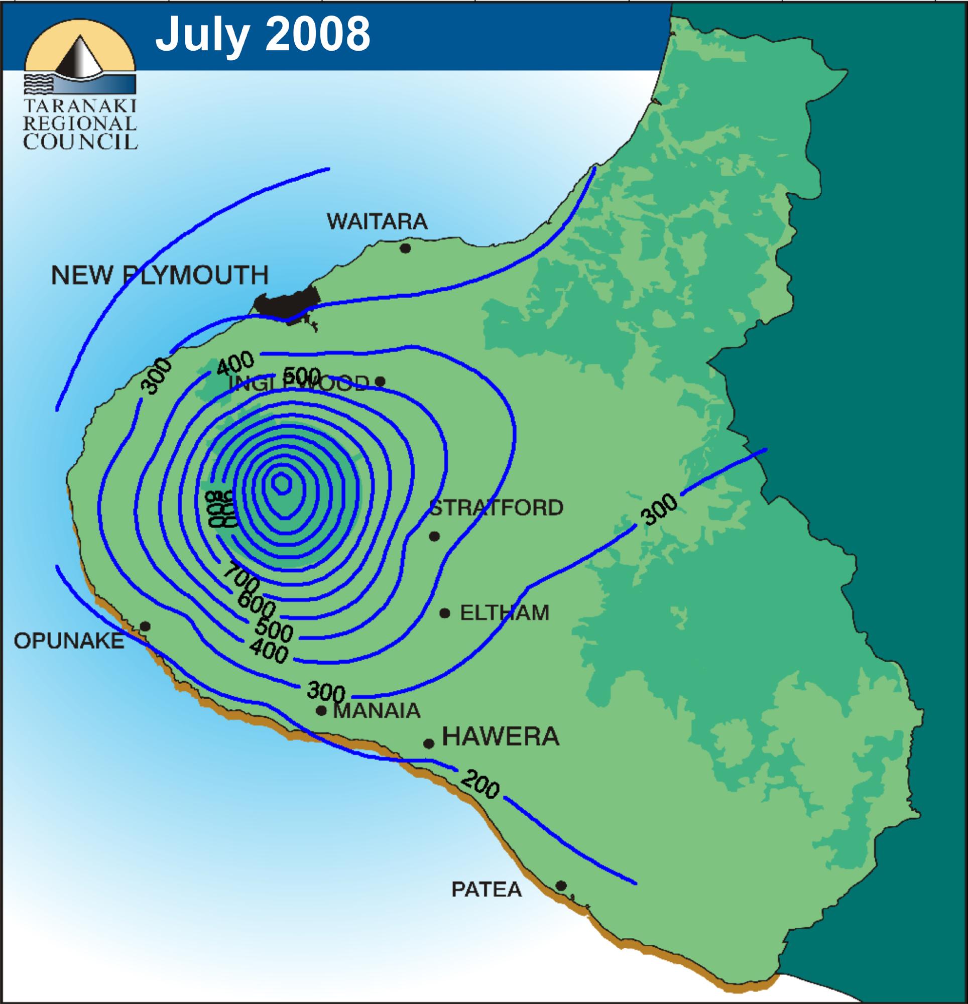
Scatterplot


Scatter plots are used to show possible relationships between two variables which share a relationship to the same thing.

The scatter plot above shows the relationship between the percentage of an area and the probability of detecting a non-event (PODn) for a forecast model used to project the most probable ceiling (altitude) and visibility for air traffic.

A scatter plot could also be used to show a probability of students being late for class after having a long weekend by figuring what percentage of students were tardy for a period of time and marking the days which followed a long weekend.  If the dots remained equally distributed, it could be figured that being late for class and students being away for long weekends have no effect upon each other.  If the dots became clustered on Monday mornings following a long weekend it could be figured that long weekends and student punctuality were directly related to each other.

Box Plot


A box plot, similar to a histogram, is a standardized way to display data distribution based on the five number summary (minimum, first quartile, median, third quartile, and maximum) and was created by John Turkey.

The box plot above shows the participation rates of eligible persons, by percentage, who took the SAT in the nine South-Atlantic states for the purpose of this survey.


Thematic Map


A thematic map is a map which shows a theme found in an area.  The theme may be average household income, single family homes, grocery stores, or whatever theme the cartographer wishes to prove.

The map above is meant to show the median age per state shown on the map.  As an example; a thematic map could be made, by using registered voter's party affiliation, to show which political party has the most members in a location.

DOQQ (Digital Orthophoto Quarter Quadrangles)


A DOQQ is a map where evenly measured samples are taken of the earth's surface and manipulated through computer software to fit the photo samples to the actual shape of the earth.  This form of mapping creates a more true interpretation of what is shown.

The DOQQ images above were used by two students at the University of Texas to show how erosion rates had changed in the area shown after Dell built a plant there.

DLG (Digital Line Graphing)


According to the USGS, "A Digital Line Graph (DLG) is digital vector data representing cartographic information."

This DLG map shows hydrography (the scientific data related to water), hysography (the measurement of earth above sea level), a public land survey, and roads in the Dixie Valley of Nevada.  Other data which DLG maps could show are utilities, boundaries, or other topographical features, all of which would be measured scientifically.

The link below is to reference information gained from the USGS.

Stem and Leaf Plot


According to Washington University, "A stem-and leaf-plot offers an alternative to a line plot or histogram for obtaining a picture of the data distribution when data can be represented as integer numbers."

This stem-and-leaf plot represents grades earned by a student.  The stem is representative of numbers to the tenth power and the leaves represent numbers to the first power.  With the information given in the stem-and-leaf plot above; the lowest grade earned is 16 and the highest is 96.  By viewing this stem-and-leaf plot; it is easy to quickly ascertain that this students grades are more frequent below 70.  This form of imagery could make it simpler and faster to prove a student's grade, rather than opening a grade book.

The link below is used to reference statements from Washington University.

Planimetric Map


According to the Wisconsin Coastal GIS Applications Project, "Planimetric features are those items that can be seen on the ground from an aerial perspective and represented on a map."

The above map shows Iceland and divides this country by its provisional and state boundaries.  Note how the use of multiple colors makes it easier to define each specific state or provisional region.  Other planimetric maps could show roadways, mountains, trees, and any other item which can be seen from an aerial perspective.  Although this map was used to determine the boundaries of states and provinces; its use was politically based. 
The webpage above has a link which opens a window that allows the picture to be enlarged so the cities' names are recognizable.

The link below is for reference to information quoted from the Wisconsin Coastal GIS Applications Project.

DEM (Digital Elevation Model)


This is a DEM (digital elevation model) of Oahu, Hawaii.  According to the USGS, "A digital elevation model (DEM) is a digital file consisting of terrain elevations for ground positions at regularly spaced horizontal intervals."  This image was taken from a satellite, which is remote imagery, and this image was used to show the elevation of Oahu's coastline.

DEMs produced by the USGS can be produced using five different elevation products, and depending on which elevation product that is used, and many other variables, the image can be either more accurate or less.

The link below is used to reference the information quoted by the USGS:
http://rmmcweb.cr.usgs.gov/elevation/dpi_dem.html

Thursday, October 14, 2010

Google Earth's and NOAA Coral Reef Watch


Satellite imagery is when, "Radiant energy from the earth is measured by a satellite radiometer and stored as digital values in two-dimensional arrays of pixels, which make up the image." (http://www.metoffice.gov.uk/science/creating/first_steps/obs_sat_imagery.html).
This is a satellite image, which I created using Google Earth, which relates to Panama City, FL. and the Gulf of Mexico near there with markers from NOAA's Coral Reef Watch using Google Earth 5.0.  Google Earth 5.0 is a free program and can be used to view any area around the globe.  So, if you wanted to see your house, or any other place, from the air; get Google Earth 5.0 and have fun!

The first website above is a link to NOAA's Coral Reef Watch page and has links which lead to the download page for Google Earth as well as the Coral Reef Watch packages.  If you decide to use Google Earth; download and install the Google Earth program, use the link above to download the Coral Reef Watch packages, and follow the instructions.

Saturday, September 4, 2010

Histogram


This histogram shows elevation on the left and the tick marks on the bottom indicate 10% of the earth's surface.  Histograms allow for distinct numerical measurements to be replaced by frequency.


Bivariate choropleth maps


Bivariate choropleth mapping allows for two different variables to be shown in the same geographical location by giving each variable its own distinct representation.  The above image shows the population of a region in 1997 and the median house value in the same region.  The differing variables are contrasted by using pink spots for population and green spots for median house value, each spot larger with numeric increase.

Doppler Radar


Doppler radar uses microwaves that are sent from the radar outward where they interact with water particles and the information is sent back to the radar where the data is computed to where an image is produced which shows the frequency, or denseness of the water and tracks it to show how fast it is moving and in what direction as well as the temperature of the water.  With doppler radar it is possible to differentiate between snow, sleet, and rain as well as tracking its motion.  The most important information which comes from dopplar radar is the tracking of storm cells in order to see if a tornado is forming, and where, or to track the strength of a hurricane from a distance.. 

Flow map


This flow map shows the migration of people from California from 1995 to 2000.  Flow maps are used to show how things move from one place to another, or as in this case, from one place to many others. 

Statistical maps


These statistical maps show how the "spread of the internet" happened between 1991 and 1997 when the study expired.  Statistical maps can give from a regional or local to a worldwide view of how there is a rise or decline in pretty-much anything.  This style of map can be used to show the frequency of violent crime or the literacy rates and can be as broad-spread as the data can produce.

Bilateral Graph


This bilateral graph shows the U.S. trade deficit in relation to India's GDP from 1980 until 2005.  Bilateral graphs are extremely useful when relating two equal or opposite factors which are data-based, and showing how they relate to each other, especially over a period of time.  A similar graph could be created which shows the U.S. debt during one president's time in office shown against another's or the amount of a pollutant during one decade and the same pollutant during another decade.  This form of graph gives the viewer an opportunity to see how things change depending on different time-frames.

Cartographic Animation


This is an example of cartographic animation.  In this image; the stages of flooding are shown as the waters continue to rise for the Tar River basin in North Carolina.  Cartographic animation is typically taken from historical data and is not an exact science but can be a useful tool when planning for natural or man-made disasters.  The data used to create this animated map is from September 1999.