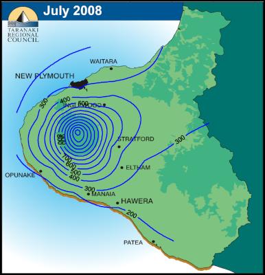
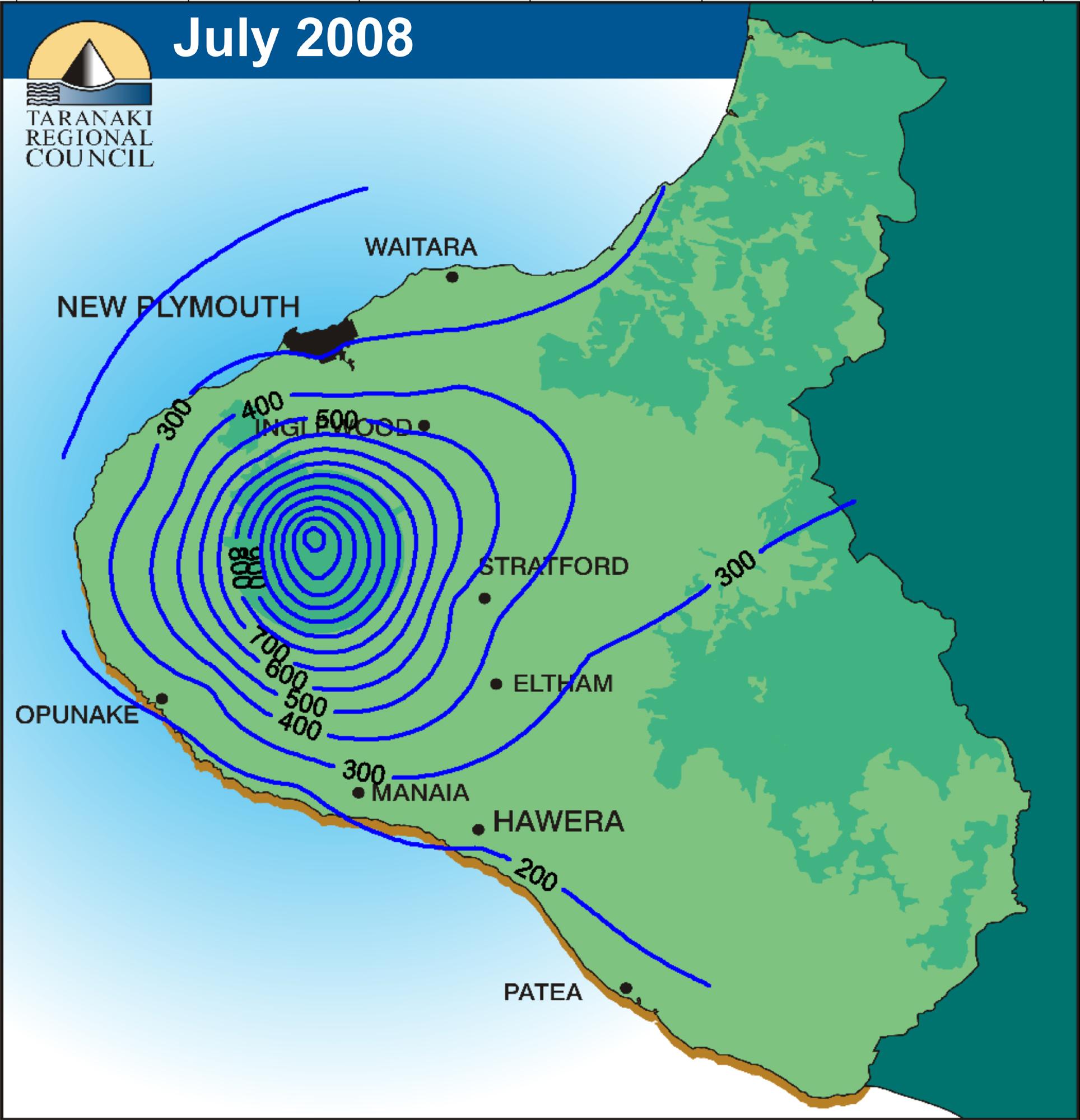
This map has isohyets, superimposed on a topographic map. Isohyets indicate the amount of precipitation over the span of a year's time, which is equal, in a specific location, as indicated on the map. The measurement used depends on how the map maker intends to measure the precipitation and can be any form of liquid measurement.
No comments:
Post a Comment